Active Pattern Set to Continue for New England

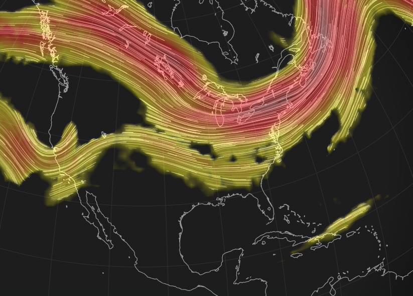
New England’s pattern will remain generally unsettled over the coming week as several disturbances move through or nearby the region. This comes as the region will remain under roughing through the rest of the week. Moving into next week, the jet stream will hang over New England, sending multiple systems through the region. With that said, not all of these systems will be particularly strong, or make a direct impact to the region.
Below: Flow at the jet stream level early next week:
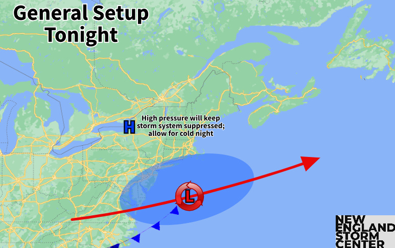
The first of these systems will be a storm system that will get suppressed well south of the region tonight into tomorrow thanks to building high pressure moving in. Some very fringe snow showers on the northern edge of the precipitation shield may clip southernmost New England, amounting to no accumulations. This building high pressure will allow for clearing skies overnight, which will set up effective radiational cooling conditions, allowing for a cold night.
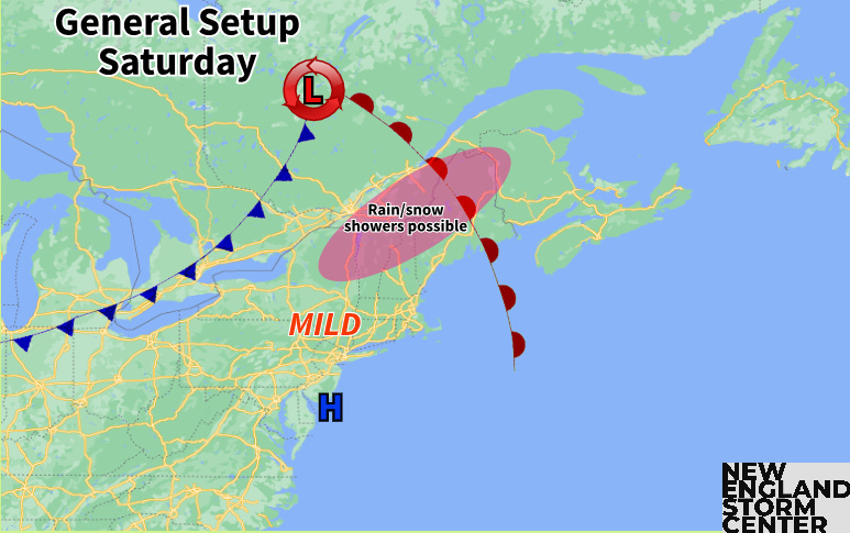
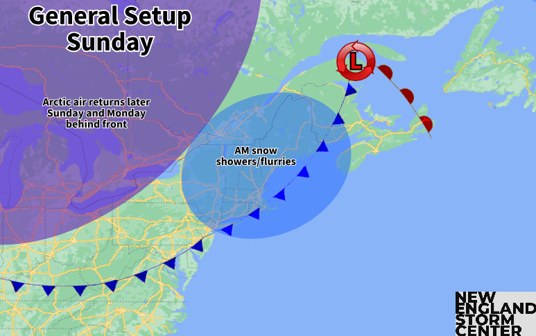
The next of these disturbances will cross New England this weekend. This system will involve a potent clipper system moving well north of New England. The system is likely to drop into the 980 millibar range, but with it crossing so far to the north, precipitation will be limited in New England. The bigger impact will come with temperatures.
A potent system will have rather strong fronts attached to it. First, a warm front will lift into the region Saturday morning. Warm air advection with this front will be strong. This will bring a mild day region-wide Saturday. The entirety of New England is likely to rise above freezing, with many areas pushing into the 40s. There will be a chance for snow or rain showers across northernmost New England throughout the day.
Later Saturday into Saturday night and Sunday morning, the system’s cold front will push through the region. Moisture remains very limited with this front, but the front itself will be strong, so there will likely be enough forcing for a quick burst of some light snow showers or flurries across the region. The bigger impact will again be on the temperatures. Sunday will be a colder day for New England than Saturday. Northern and western New England may be sharply colder as the front enters these areas Saturday night.
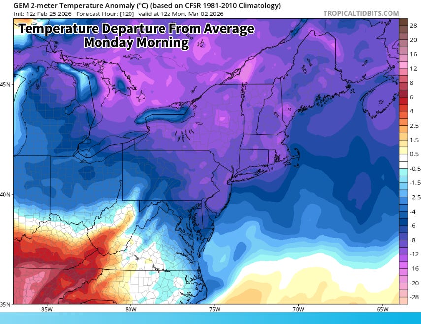
The core of this Arctic outbreak will settle over New England Sunday night and Monday. Highs on Monday are unlikely to break out of the 20s across southern and central New England, with temperatures likely struggling to climb out of the teens across the northern tier. While there may be some gusty winds initially Sunday night and Monday morning, building high pressure should calm these winds, so wind chills won’t be as brutal as previous Arctic blasts this winter.
Another storm system in this active pattern will be nearby on Monday into Monday night as well. Currently, trends favor this system getting suppressed south by a rather strong area of Canadian high pressure building toward New England. This high pressure will help deliver this quick shot of cold air. The system will be in the vicinity, however, and will bear keeping at least an eye on in the coming days. Overall, it may end up playing out similar to tonight’s setup.
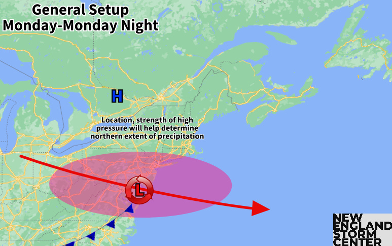
The main impacts from this system are expected to remain south of New England, across the Mid-Atlantic. There’s enough variability and room for track changes in regards to both the low pressure and high pressure systems that trends will be watched. With the system likely diving south, it will be southernmost New England will have the highest chance at seeing precipitation make it into the area. Again, the favored outcome is for the system to be suppressed south.
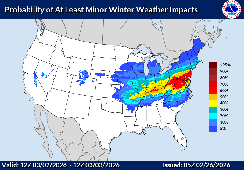
Below: Current probability of minor winter weather impacts Monday and Monday night:
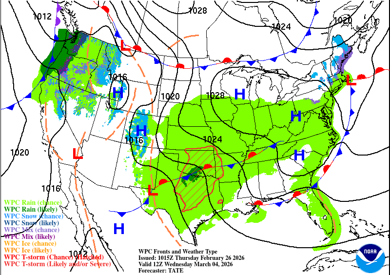
Another system will quickly follow behind this one, which is poised to move through later Tuesday into Wednesday. By then, temperatures will be moderating back closer to seasonable levels for early March. This, along with the system’s potential track, will favor this system bringing rain and snow showers to the region.
Currently, guidance remains at odds over the track and timing of the system. Both of these will determine where any potential rain/snow line sets up and how much precipitation will fall. Given the massive spread in outcomes, it’s impossible to try to get into further details at this point.
Below: Current weather map for Wednesday morning (March 4):
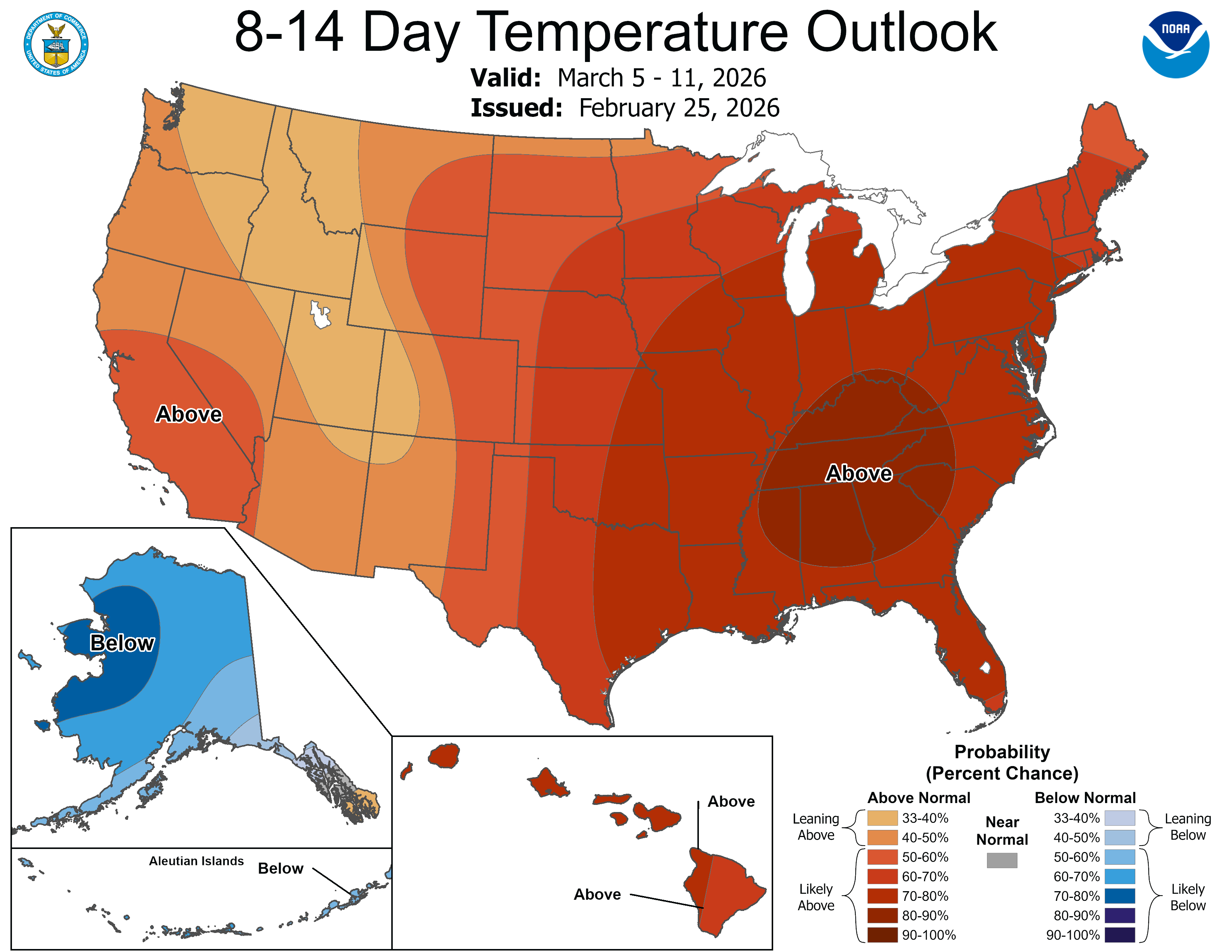
Taking a look at the longer term, there are signals for more warmth to get into New England eventually. There are signs of a building ridge along the east coast moving later into next week. While it may take a while to reach New England, the second week of the month is looking generally milder. The extent of the warmth remains to be seen.